80 matches for themes: 'gold rush','built environment','land and ecology'
Diverse state (200) Aboriginal culture (38) Built environment (45) Creative life (66) Family histories (9) Gold rush (11) Immigrants and emigrants (36) Kelly country (3) Land and ecology (34) Local stories (65) Service and sacrifice (20) Sporting life (8)-

Early Photographs - Landscapes and Streetscapes
Antoine Fauchery and Richard Daintree's images offer rare fine quality images of early Victorian landscapes and Melbourne streets of the late 1850s.
Antoine Fauchery and Richard Daintree's Sun Pictures of Victoria was the first photographic album of Australian scenes made available for sale to the public.
Using the latest in photographic techniques of the time, the Fauchery-Daintree images offer rare fine quality images of early Victorian landscapes and Melbourne streets of the late 1850s; from pristine waterfalls, to the already altered Yarra River, to the dusty corner of Spring and Bourke Streets.
Further material can be found at the State Library of Victoria's Ergo site: Early Street Names of Melbourne
-
 Wind & Sky Productions
Many Roads: Stories of the Chinese on the goldfields
In the 1850s tens of thousands of Chinese people flocked to Victoria, joining people from nations around the world who came here chasing the lure of gold.
Fleeing violence, famine and poverty in their homeland Chinese goldseekers sought fortune for their families in the place they called ‘New Gold Mountain’. Chinese gold miners were discriminated against and often shunned by Europeans. Despite this they carved out lives in this strange new land.
The Chinese took many roads to the goldfields. They left markers, gardens, wells and place names, some which still remain in the landscape today. After a punitive tax was laid on ships to Victoria carrying Chinese passengers, ship captains dropped their passengers off in far away ports, leaving Chinese voyagers to walk the long way hundreds of kilometres overland to the goldfields. After 1857 the sea port of Robe in South Australia became the most popular landing point. It’s estimated 17,000 Chinese, mostly men, predominantly from Southern China, walked to Victoria from Robe following over 400kms of tracks.
At the peak migration point of the late 1850s the Chinese made up one in five of the male population in fabled gold mining towns of Victoria such as Ballarat, Bendigo, Castlemaine, Beechworth and Ararat. It was not just miners who took the perilous journey. Doctors, gardeners, artisans and business people voyaged here and contributed to Victoria’s economy, health and cultural life. As the nineteenth century wore on and successful miners and entrepreneurs returned home, the Chinese Victorian population dwindled. However some chose to settle here and Chinese culture, family life, ceremony and work ethic became a distinctive feature of many regional Victorian towns well into the twentieth century.
By the later twentieth century many of the Chinese relics, landscapes and legacy of the goldrush era were hidden or forgotten. Today we are beginning to unearth and celebrate the extent of the Chinese influence in the making of Victoria, which reaches farther back than many have realised.
-
 Jary Nemo and Lucinda Horrocks
Collections & Climate Change
The world is changing. Change is a natural part of the Earth’s cycle and of the things that live on it, but what we are seeing now is both like and unlike the shifts we have seen before.
Anthropogenic change, meaning change created by humans, is having an impact on a global scale. In particular, human activity has altered the composition of the Earth’s atmosphere, causing the world’s climate to change.
Already in the state of Victoria we are seeing evidence of this change around us. In the natural world, coastal waters are warming and bringing tropical marine species to our bays. Desert animals are migrating to Victoria. Alpine winters are changing, potentially putting plants and animals at risk of starvation and pushing species closer to the margins. In the world of humans, island and coastal dwellers deal with the tangible and intangible impacts of loss as sea levels rise, bush dwellers live with an increased risk of life-threatening fires, farmers cope with the new normal of longer droughts, and we all face extreme weather events and the impacts of social and economic change.
This Collections and Climate Change digital story explores how Victoria’s scientific and cultural collections help us understand climate change. It focuses on three Victorian institutions - Museums Victoria, the Royal Botanic Gardens Victoria and Parks Victoria. It looks at how the information gathered and maintained by a dedicated community of researchers, curators, scientists, specialists and volunteers can help us understand and prepare for a hotter, drier, more inundated world.
The story is made up of a short documentary film and twenty-one examples highlighting how botanical records, geological and biological specimens and living flora and fauna provide a crucial resource for scientists striving to map continuity, variability and change in the natural world. And it helps us rethink the significance of some of Victoria’s cultural collections in the face of a changing climate.
-
Pangerang Country with Freddie Dowling
Indigenous Warning: Please be aware that this story contains imagery and representation of people that may be deceased, and images of places that could cause sorrow.
In this story Freddie Dowling, Pangerang Elder, introduces us to several Pangerang stories and sites.
The Pangerang people were a nation of sub-clans who occupied much of what is now North Eastern Victoria stretching along the Tongala (Murray) River to Echuca and into the areas of the southern Riverina in New South Wales. Their land includes the Wangaratta, Yarrawonga and Shepparton areas through which the Kialla (Goulburn) and Torryong (Ovens) Rivers flow. The approximate boundaries are south to Mansfield, west to Echuca, east to Chiltern and north to near Narrandera in New South Wales.
Freddie Dowling learnt the stories of the indigenous people of this area from his grandmother, Annie Lewis, and his father, Frank ‘Munja’ Dowling.
The Pangerang words used in this story were written down by Annie Lewis in 1900. She learned them from her mother, Luana ‘Lily’ Milawa. Freddie remembers that both his grandmother and father spoke these words. His father also taught him to speak while hunting and travelling in the bush of their country.
The word Pangerang is often written and known as Bangerang, and Banerang, 'because, in our language, "puh" and "buh" sound similar' (Freddie Dowling).
-

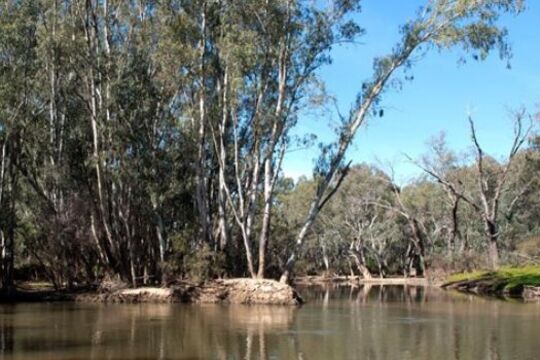
Seeing the Land from an Aboriginal Canoe
This project explores the significant contribution Aboriginal people made in colonial times by guiding people and stock across the river systems of Victoria.
Before European colonisation Aboriginal people managed the place we now know as Victoria for millennia. Waterways were a big part of that management. Rivers and waterholes were part of the spiritual landscape, they were valuable sources of food and resources, and rivers were a useful way to travel. Skills such as swimming, fishing, canoe building and navigation were an important aspect of Aboriginal Victorian life.
European explorers and colonists arrived in Victoria from the 1830s onwards. The newcomers dispossessed the Aboriginal people of their land, moving swiftly to the best sites which tended to be close to water resources. At times it was a violent dispossession. There was resistance. There were massacres. People were forcibly moved from their traditional lands. This is well known. What is less well known is the ways Aboriginal people helped the newcomers understand and survive in their new environment. And Victoria’s river system was a significant part of that new environment.
To understand this world we need to cast ourselves back into the 19th century to a time before bridges and cars, where rivers were central to transport and movement of goods and people. All people who lived in this landscape needed water, but water was also dangerous. Rivers flooded. You could drown in them. And in that early period many Europeans did not know how to swim. So there was a real dilemma for the newcomers settling in Victoria – how to safely cross the rivers and use the rivers to transport stock and goods.
The newcomers benefited greatly from Aboriginal navigational skills and the Aboriginal bark canoe.
CULTURAL WARNING: Aboriginal and Torres Strait Islander users are warned that this material may contain images of deceased persons and images of places that could cause sorrow.
-

Wimmera Stories: Murtoa Stick Shed, Enduring Ingenuity
Colloquially known as the Stick Shed, the Marmalake Grain Store Wheat Storage Shed is the largest building in Murtoa, out on the Wimmera plains between Horsham and St Arnaud.
The Stick Shed is a type of grain storage facility built in Victoria during the early 1940s. The Marmalake / Murtoa Grain Store No.1 was built in 1941-42 during a wheat glut, to store wheat that could not be exported during World War II. It is the earliest & last remaining example of this particular grand Australian rural vernacular tradition.
The Stick Shed is 265 metres long, 60.5 metres wide and 19-20 metres high, supported by 560 unmilled mountain ash poles. Its vast gabled interior space and long rows of poles have been likened to the nave of a cathedral.
The Stick Shed demonstrates Australian ingenuity during a time of hardship, it was added to the Victorian Heritage Register in 1990.
Find more stories and photographs about the Stick Shed on the Way Back Then blog.
-

Young and Jackson Hotel
The Young and Jackson Hotel, built in the 1850s, is one of Australia's most well known hotels. It was built, as the Princes Bridge Hotel, on part of an allotment originally purchased by John Batman in 1837.
Young and Jackson were both born in Dublin, and "chummed together" to New Zealand chasing the Otago gold deposits in 1861. It is not known when they came to Victoria, but they purchased the lease on the Princes Bridge Hotel in 1875.
-

Melbourne Trams: Step aboard!
'Introduction to Melbourne Trams: Step aboard!'
Written by Carla Pascoe, May 2012
Trams are what make Melbourne distinctive as a city. For interstate and overseas visitors, one of the experiences considered compulsory is to ride a tram. When Melbourne is presented to the rest of the world, the tram is often the icon used. The flying tram was one of the most unforgettable moments of the Opening Ceremony of the 2006 Commonwealth Games. When Queen Elizabeth II visited Australia in 2011, she was trundled with regal dignity along St Kilda Road in her very own ‘royal tram’.
The history of trams is closely bound up with the history of this southerly metropolis. Melbourne’s tram system originated during the 1880s economic boom when the Melbourne Tramway and Omnibus Company opened the first cable line. Cable tram routes soon criss-crossed much of the growing city and cable engine houses can still be seen in some inner suburbs, such as the grand building on the south-east corner of Gertrude and Nicholson streets, Fitzroy. Some older passengers like Daphne Rooms still remember riding cable cars.
In the late 19th century, cable and electric tram technologies were vying for supremacy. Australia’s first electric tram line opened in 1889, running through what was then farmland from Box Hill station to Doncaster. The only surviving clue that a tram line once traversed this eastern suburb is the eponymous Tram Road, which follows the former tram route in Doncaster.
Gradually, various local councils joined together to create municipal Tramways Trusts, constructing electric lines that extended the reach of the cable system. In 1920 the tram system came under centralised control when the Melbourne and Metropolitan Tramways Board (MMTB) consolidated the routes and began electrifying all cable lines.
Manpower shortages during World War II meant that Australian women stepped into many roles previously reserved for men. The tramways were no exception, with women being recruited as tram conductors for the first time. After the war, tram systems were slowly shut down in cities around both Australia and the world, as transport policies favoured the motor vehicle. But thanks to the stubborn resistance of MMTB Chairman, Sir Robert Risson, as well as the wide, flat streets that characterise the city’s geography, Melbourne retained its trams.
Melbourne’s tram industry has always possessed a unique workplace culture, characterised by fierce camaraderie and pride in the role of the ‘trammie’ (the nickname for a tram worker). Many Trammies, like Bruce MacKenzie, recall that they joined the tramways because a government job was seen as a job for life. But the reason they often remain for decades in the job is because of the strong bonds within the trammie ‘family’. This is partly due to the many social events and sporting clubs that have been attended by Trammies, as Bruce MacKenzie remembers. It is also because the demands of shift work bond people together, explains Roberto D’Andrea.
The tram industry once employed mainly working-class, Anglo-Australian men. After World War II, many returned servicemen joined the ranks, bringing a military-style discipline with them. With waves of post-war migration the industry became more ethnically diverse, as Lou Di Gregorio recalls. Initially receiving Italian and Greek workers from the 1950s and 1960s, from the 1970s the tramways welcomed an even broader range of Trammies, from Vietnamese, South American, Turkish and other backgrounds.
Trammies perform a wide range of tasks critical to keeping the system running, including driving, track maintenance, tram maintenance, time tabling, customer service and more. But just as designs of ‘rolling stock’ have changed - from the beloved veteran W class trams to the modern trams with their low floors, climate control and greater capacity - so too have the jobs of Trammies changed over time. Bruce MacKenzie remembers joining the Preston Workshops in the 1950s when all of Melbourne’s fleet was constructed by hand in this giant tram factory. Roberto D’Andrea fondly recalls the way that flamboyant conductors of the 1980s and 1990s would perform to a tram-load of passengers and get them talking together. As a passenger, Daphne Rooms remembers gratefully the helping role that the connies would play by offering a steadying arm or a piece of travel advice.
Trams have moved Melburnians around their metropolis for decades. As Daphne maintains, ‘If you can’t get there by tram, it’s not worth going’. Everyone has memories of their experiences travelling on trams: some funny, some heart-warming and some frustrating. Tram driver, Lenny Bates, tells the poignant story of the blind boy who would sometimes board his tram on Collins Street and unhesitatingly call out the names of the streets they passed. As the films in this collection demonstrate, every passenger has their routes that they customarily ride and these routes take on a personal meaning to their regulars. You could say that every tram line has its own distinct personality. Whilst the way the tram system is run inevitably changes across time, one thing has been constant: trams have always played a central role in the theatre of everyday life in Melbourne.
-
 Erin Wilson
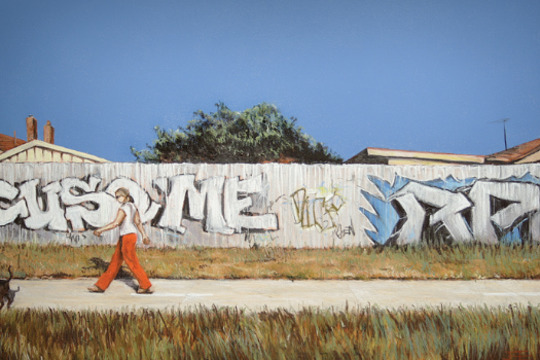
Urban Fringe
Melbourne is an expanding city, with a growing population and sprawling urban development. It is predicted that by 2056 an additional 4 million people will settle in Greater Melbourne, increasing the population from 5 million to 9 million people over the next 30 years (1). While some expansion is vertical, in the form of high-rise developments, much of this growth is across the peri-urban fringe, described simply as ‘areas on the urban periphery into which cities expand’ (2) or ‘which cities influence’ (3).
In Melbourne, these peri-urban areas of most rapid growth are currently the local government areas of Cardinia, Casey, Hume, Melton, Mitchell, Whittlesea and Wyndham. With population growth comes the inevitable expansion of infrastructure, services and transportation. As the fringes of the city continue to sprawl, what was once the urban fringe and green edge of the city has to be negotiated, as it is increasingly encroached upon.
The artists and photographers in Urban Fringe examine these spaces on the fringe of the expanding city of Melbourne, where urban and natural environments meet, clash and coexist. Beginning with white colonisation and the myth of ‘terra nullius’, these artists discuss the treatment of the Greater Melbourne environment over time, consider the cost of progress, and explore protest and the reclamation of space.
-
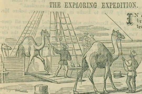
Burke and Wills: Have Camels Will Travel
Dromedary camels were introduced to Australia in 1840. The first significant shipment, however, was made to service the Burke and Wills expedition, which was the first exploring party to use camels, as well as horses, for transporting supplies.
In 1858, George Landells, who had worked as a horse trader in India, wrote to the Victorian Government explaining how the camel was ideally suited to the Australian landscape. He offered to travel to India and purchase camels on behalf of the Victorian government for use in exploration, and as the basis of a breeding stud. The government’s Board of Science and Zoological Gardens Committee agreed that the camel would be useful on the Australian continent, and Landells was authorised to borrow money from the Indian Government and make the purchase.
Landells traveled through India, Pakistan and Afghanistan to source the animals, engaging eight camel drivers to assist him on the journey from Karachi to Melbourne in December 1859, arriving mid-June 1860.
He was hailed for his travels through the ‘very unsettled’ lands by the English Scindian Newspaper, and similarly lauded in Melbourne where the ‘exotic’ animals caused a sensation, as did their handlers, identified variously as Indians, Sepoys, and Malays.
Partly in response to his fame, Landells was appointed second in command of the Burke and Wills expedition. He was also appointed officer in charge of the camels.
Landells recruited John Drakeford and John King, who had helped him bring the animals from Karachi to Melbourne, and four of the eight handlers: Samla (described by Becker as a Hindu), Dost Mahomet (or Botan), from Guznee; Esau Khan (or Hissand or Isaah), Belooch, who came from Mahadpoor in the Punjab, and another man from Kelat.
The expedition party departed Melbourne with 26 camels. As the expedition progressed, Landells and Burke disagreed over their treatment and Landells resigned in Menindee.
Four of the 26 camels were left at Menindee. Dost Mahomet stayed with 16 at the Coopers Creek depot. Burke and Wills took six animals with them on their trek to the Gulf and John King, travelled with them, to care for. Some of the animals strayed or were lost, others were abandoned. Burke, Wills, Charlie Gray and John King ate the last of them, as they struggled back from the Gulf of Carpentaria.
However the Burke and Wills Expedition was not the end of the story. Camels had proved their worth in negotiating the harsh and dry Australian interior and camels became an increasingly important form of transport in the Australian inland. Between 1870 and 1900, over 15,000 camels and 2000 cameleers were brought to Australia. The cameleers were commonly known as “Afghans” although small in number, they made a vital contribution to Australia’s exploration and development.
Feral camels now roam across outback Australia. In response, markets for live camels and camel meat have developed. It is more than likely that the descendents of Landells’ camels are among those that now roam the Australian continent.
-

Wimmera Stories: Nhill Aeradio Station, Navigating Safely
The Nhill Aeradio Station was a part of a vital national network established in 1938 to provide critical communications and navigation support for an increasing amount of civil aircraft.
Situated at the half-way point of a direct air-route between Adelaide and Melbourne, Nhill was an ideal location for an aeradio station and was one of seventeen such facilities originally built across Australia and New Guinea by Amalgamated Wireless Australasia Ltd (AWA) under contract from the Commonwealth Government.
The Aeradio Station at Nhill operated until 1971, when a new VHF communication network at Mt William in the Grampians rendered it obsolete and the station was decommissioned.
The aeradio building survives today in remarkably original condition, and current work is being undertaken by the Nhill Aviation Heritage Centre group to restore the Aeradio Building and interpret its story as part of a local aviation museum.
-
Melbourne and Smellbourne
Over the last 150 years Victoria has experienced a number of landmark capital works and landscaping projects in response to its changing economic, environmental and cultural relationship to water. The sewerage system that we take for granted today had to be built from scratch.
For all the grandeur that was 'Marvellous Melbourne' in the 1880s, the city was nicknamed 'Smellbourne', and for good reason. The building of Yan Yean Reservoir in the 1850s had ensured the availability of fresh water, but there was still no sewerage system.
An appalling stench wafted from the many cesspits and open drains. 'Nightsoil' (as human waste was politely referred to) polluted the streets and ran into the Yarra. Nightsoil collectors frequently dumped their loads on public roads. Ignorance and neglect of the hygienic disposal of human waste had devastating results at this time when hundreds died in a savage outbreak of typhoid.
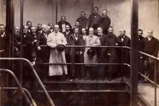
Melbourne and Metropolitan Board of Works
In 1891 the Melbourne and Metropolitan Board of Works (MMBW) was created. It immediately began plans to build an underground drainage system linked to a pumping station at Spotswood, located on the western banks of the mouth of the Yarra River. The sewage flowed by gravity to Spotswood, where it was then pumped to the Werribee Treatment Farm.
Spotswood Pumping Station
Spotswood Pumping Station built to pump Melbourne's sewage to Werribee, was finished in 1897. At the pumping station, steam engines (later replaced by electrical ones) worked to pump the sewage up a rising main to join the major sewer outfall at the head of the pumping mains near Millers Road at Brooklyn. The outfall sewer then carried the sewage to the Werribee Treatment Farm where it was purified and discharged into the sea.
Werribee Farm
Werribee was the perfect site for the MMBW's new sewage farm. The farm was the Board's most important project, and one of the largest public works undertaken in Australia in the nineteenth century.
Land at Werribee was cheaper than at Mordialloc - the other site considered. Rainfall was low compared with the rest of Melbourne, which meant the land would adapt well to irrigation. Werribee was also 9 miles (14.4 KM) away from the nearest boundary of the metropolitan district (Williamstown), and 24 miles (38.6 KM) away from the influential and well-to-do suburb of Brighton. The Chirnside family sold 8,857 acres (3.2 hectares) to the Board for 17 pounds per acre.
The Earl of Hopetoun, Governor of Victoria, turned the first sod of earth in a ceremony on May 1892, which marked the beginning of the building of the outfall sewer near Werribee.
Connection!
On 5 February 1898, a ceremony marked the official connection of Melbourne to the new sewerage system. Guests - politicians, board members, city councillors and federal delegates - boarded a steamer to watch the Governor, Lord Brassey, raise the penstock (the partition between the smaller and larger sewers) at the Australian Wharf. They then visited the pumping station at Spotswood and the sewage farm at Werribee. Horses and carts conveyed the 180 guests around the farm.
After lunch and toasts, many of which looked forward to the future of a federated Australia, MMBW Chairman Mr Fitzgibbon proudly declared it "was not a question of how much the scheme was going to cost, but how much it was going to save in the lives of the citizens." Before the work was completed he hoped to see those puny punsters and petty wits who spoke of Melbourne as Marvellous Smellbourne constrained to speak of her as one of the sweetest and healthiest cities of the world.
-

Mapping Great Change
This series of films and stories is centred on a beautiful and complex map with the ungainly name: Plan of the General Survey from the Town of Malmsbury to the Porcupine Inn, from the sources of Forest Creek to Golden Point, shewing the Alexandrian Range, also Sawpit Gully, Bendigo and Bullock Creeks.
In many ways, the map is a mirror of our times: the map is a record of the 'critical years' between 1835 and 1852 in which the dispossession of Aboriginal people of Victoria was allowed to occur; we contemporary people are in the "critical decade" for making the changes necessary to avoid catastrophic climate change.
If we fail to act effectively in this decade, it will be as loaded with moral and practical consequences for coming generations as the moral and policy failures of our colonial ancestors was for the Traditional Owners of the land.
-
 Paige Gleeson
Making Do on ‘the Susso’: The material culture of the Great Depression
There are currently 5.25 trillion pieces of plastic in our oceans. The demands on renewable sources like timber, clean water and soil are so great they are now being used at almost twice the rate that the earth can replenish them. Finite resources like fossil fuel are consumed at an alarming rate, changing the earth’s climate and pushing animal species to the brink of extinction. Current patterns of consumption are exceeding the capacity of the earth’s ability to provide into the future.
All over the world, environmental movements concerned with sustainability have sprung up in response. Conscious consumers are advocating for their right to repair their own electronic devices, fighting a culture of planned obsolesce and disposability. Others are championing the repair, reuse and recycling of clothing and household goods to extend their lives. Reducing waste in the kitchen and promoting food options with lower environmental impact has become increasingly popular.
Climate change may be a uniquely twenty-first century challenge, but sustainability has a history. In 2021 many people are making a conscious choice to embrace anti-consumerism, but during the Great Depression of the 1930s it was necessity that drove a philosophy of mend and make do.
In 1929 stock markets crashed and sent economies around the western world into free fall, triggering the Great Depression. Australia’s economic dependence on wool and wheat exports meant that it was one of the worst affected countries in the world. The impact of the Depression on the everyday lives of Australians was immense. Not everyone was effected with the same severity, but few escaped the poverty and austerity of the years 1929-1933 unscathed.At the height of the Depression in 1932 Australia had an unemployment rate of 29%, and thousands of desperate people around the country queued for the dole. Aboriginal Australians were not eligible for the dole, and had to rely solely on government issued rations.
-
 Malcolm McKinnon
John Teasdale – Chronicle of a Country Life
These little films from Victoria's Western Plains are about the actual and the everyday.
They have no hint of sensationalism in them. They are plain and utterly honest. They tell us about tractors and farming machinery. About fire and flood and snow. We glimpse Anzac Day and are touched by the irony of people remembering in a time and place few people remember or think about today. But there is no sentimentality in these films either. They are just plain good. - Martin Flanagan.
John Teasdale (1936 – 2004) was a farmer at Rupanyup in the Victorian Wimmera. He was also a keen and highly accomplished cinematographer, filming consistently for over 50 years to create a long-term record of working life on a family farm and of community life in a particular part of rural Victoria.
When television arrived in Australia in 1956, John successfully applied to the ABC to become a 'stringer' cameraman, shooting regional footage that was frequently included in state-wide news broadcasts and in segments produced particularly for regional viewers. John continued in this role for thirty years, until changing technology eventually made the role of 'regional stringers' obsolete.
The Teasdale film collection constitutes a nationally significant record of working and community life in a small Australian dry-land farming community, reflecting enormous changes in farming practices as well as transformations in the character and scale of community life in and around Rupanyup. At a time when many dry-land farming communities are actively reinventing themselves as their underlying social and economic structures change dramatically, John Teasdale’s films provide a critical point of reference and affirmation.
Artist and filmmaker Malcolm McKinnon, with the support of John Teasdale’s family, is undertaking ongoing work to interpret and celebrate this rich and resonant archive.
-

Melbourne's Homes
These house plans from the late 19th and early 20th Centuries, give us an indication of how those with the means to build larger houses lived.
Servant's quarters, groom's rooms, sculleries, stables, parlours and children's areas give us clues to social attitudes, relationships to children and employees, social mores and living conditions.